An Immersive Map of a Medieval Metropolis
The year 1300 is an especially interesting time in Angkor’s history. While eyewitness reports from Chinese dignitaries only three years prior describe a bustling and wealthy city, new geoarchaeological research suggests a protracted demographic decline soon followed. It was the beginning of the end for Angkor. Much remains an enigma about this city, and we must necessarily draw upon a wide range of primary and secondary sources.
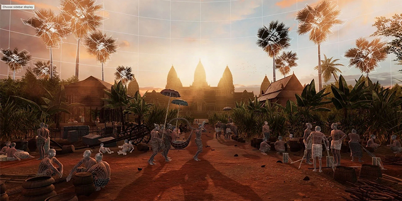
Our foundation is the GIS datasets and airborne LIDAR surveys of Greater Angkor. Still, there are also other sources, including ethnomusicology, historical accounts, archival photography and most importantly, the inscriptions that the people of Angkor wrote themselves. Using digital technologies, we have worked to translate maps of a modern-day ruin into a living, operational metropolis, replete with glittering temples, dense wooden settlements, and a fully animated populace.
Researchers
-

Associate Professor Tom Chandler
Director, Work Integrated Learning
-

Mike Yeates
Assistant Lecturer (Ed-Focused)
-

Chandara Ung
Research Assistant
-
Martin Polkinghorne
Flinders University
-
Adam Clulow
-
Bernard Keo
-
Brent McKee
Research Assistant